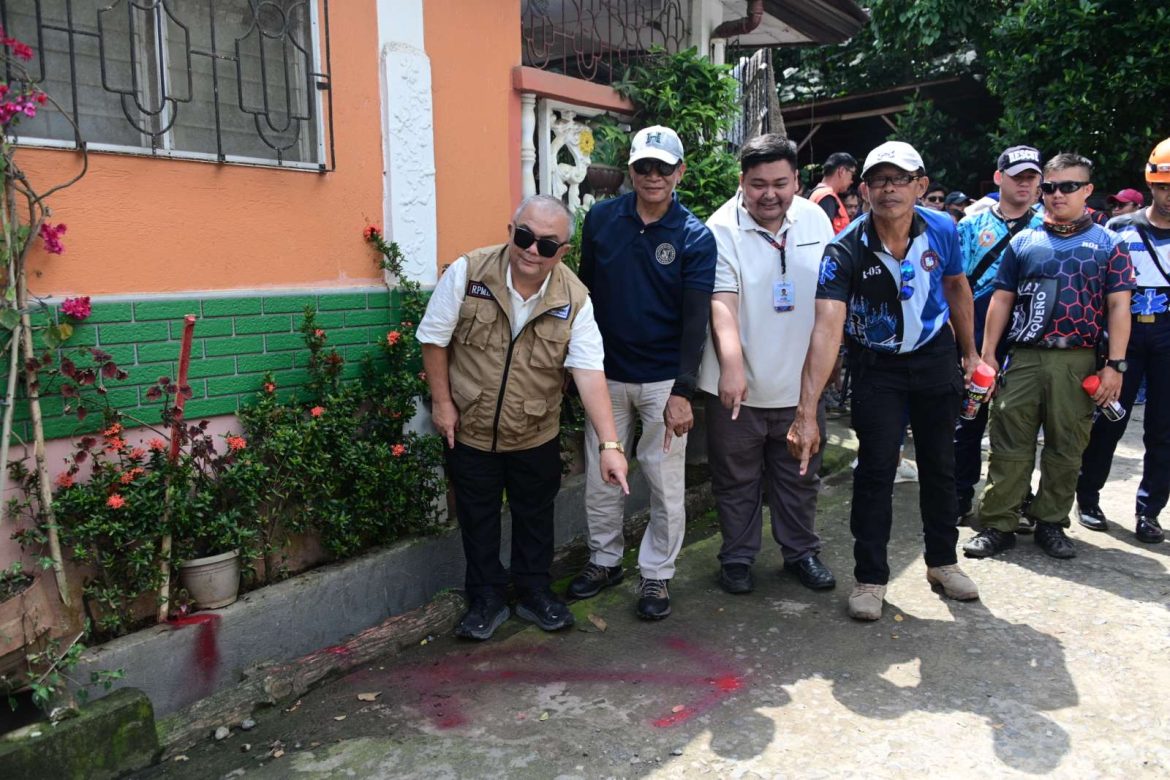
THE CITY Disaster Risk Reduction Management Office (CDRRMO) announced on Tuesday that a Walk the Fault campaign is set for October first week.
“By the first week of October, we will conduct an interagency Walk the Fault,” Rodolfo Encabo, CDRRMO assistant department head, said in an interview with city-run disaster radio.
The Walk the Fault activity will be simultaneously conducted in various areas through the Office of the Civil Defense XI (OCD XI) and the Department of Science and Technology- Philippine Institute of Volcanology and Seismology (DOST-PHIVOLCS), CDRRMO, and barangay local government units.
“We will divide into cluster groups into areas where possible identified fault lines are,” Encabo said.
The Walk the Fault is focused on areas along the fault line, where participants will have firsthand insight into the region’s seismic vulnerabilities. The initiative is part of the proactive measures to inform and educate Dabawenyos, especially those who live on top of fault lines.
CDRRMO emphasized that through the identification and marking of fault lines, residents will be informed of the specific fault conditions affecting their areas and effective responses to potential hazards.
Last year, the activity involved identifying and marking the exact locations of fault lines in eight barangays in the city. These were Tamugan, Calinan, Riverside, Los Amigos, Tugbok Proper, Bangkas Heights, Binugao, and Sirawan.
The Central Davao Fault System has five segments, including the Tamugan Fault, Lacson Fault, Dacudao Fault, Pangyan-Biao Fault, and New Carmen Fault.
Tamugan Fault is 25 kilometers long and can produce a 6.7-magnitude earthquake. The barangays that transect the Tamugan Fault are Tamugan, Gumalang, Malagos, Baguio, Cawayan, Subasta, Tagakpan, Manambulan, Mulig, Camansi, Alambre, Tagluno, Lizada, Sirawan, and Binugao.
Lacson Fault, with 33 kms, can trigger a 6.8-magnitude quake. It covers barangays Lacson, Malagos, Calinan, Wangan, Subasta, Balengaeng, Los Amigos, Angalan, Tugbok, Mintal, Bago Oshiro, Banka Heights, Baliok, and Lubogan.
Meanwhile, 18-kilometer Dacudao Fault, with a 6.5-magnitude quake, include Lamanan, Lacson, Dacudao, Calinan, Talomo River, Riverside, Los Amigos, Ula, Tugbok, Mintal, Sto. Niño, Catalunan Grande, Catalunan Pequeño, and Talomo.
The Pangyan-Biao with 33 kms and 6.8-magnitude quake are barangays Lumiad, Paquibato, Pañalum, Malabog, Sumimao, Dominga, Dacudao, Pangyan, Talandang, Biao Joaquin, Biao Escuela, Biao Guianga, and Matina Biao.
The 12-kilometer New Carmen Fault may cause a 6.3-magnitude earthquake. The barangays New Valencia, New Carmen, Matina Biao, and Langub transect this fault.
Photo from City Government of Davao


