
In the age of globalization and urban development, we might often ask, how can we safeguard our own identity as a city and as a nation? When we travel to certain places in Asia, we are often amazed at how culturally alive there cities are. Their identity are always intact with their country. For example, when we go to Singapore, we immediately see Singapore as we step on the grounds of the country. And when we go to Japan, for example, we are sure that when we step on Japan, we are in Japan.
This sense of identity of a country is because of their urban and cultural landscape that has been intact for generations and generations. Somehow, they have gracefully conserved that identity while embracing modern urban development.
So how can nations showcase their cultural identity?
UNESCO has actually crafted a toolkit to address this problem of dying urban identity of a place. The toolkit is called Historic Urban Landscape toolkit and it answers the question, “How can culture and heritage help cities in an era of globalization?”
The idea that cities will be similar in the future is acknowledge by this toolkit. Finance, Information Technology and patterns of modern urban development are the factors that make a city similar to each other. But what makes a city different from one another.
The answer is Culture and Heritage. This is the resource that makes a city different and highlights its unique character and thereby giving a more international visibility.
That is why, it is important for cities to acknowledge its cultural and heritage resources whilst embracing development.
There are actually 6 critical steps of doing this according to the Historic Urban Landscape of UNESCO. First is to “to undertake comprehensive surveys and mapping of the city’s natural, cultural and human resources”;
Second is to “reach consensus using participatory planning and stakeholder consultations on what values to protect for transmission to future generations and to determine the attributes that carry these values;
Third, “to assess vulnerability of these attributes to socio-economic stresses and impacts of climate change;”
Fourth, “to integrate urban heritage values and their vulnerability status into a wider framework of city development, which shall provide indications of areas of heritage sensitivity that require careful attention to planning, design and implementation of development projects;
Fifth, “to prioritize actions for conservation and development; and Sixth, “to establish the appropriate partnerships and local management frameworks for each of the identified projects for conservation and development, as well as to develop mechanisms for the coordination of the various activities between different actors, both public and private.”
On February 16, 2019, SwitoDesigns,Inc initiated a mini workshop on the introduction of Historical Urban Landscape at the Swito Social Innovation Hub Coworking and Makerspace called “ Visualizing a Cities Urban and Cultural Heritage”.
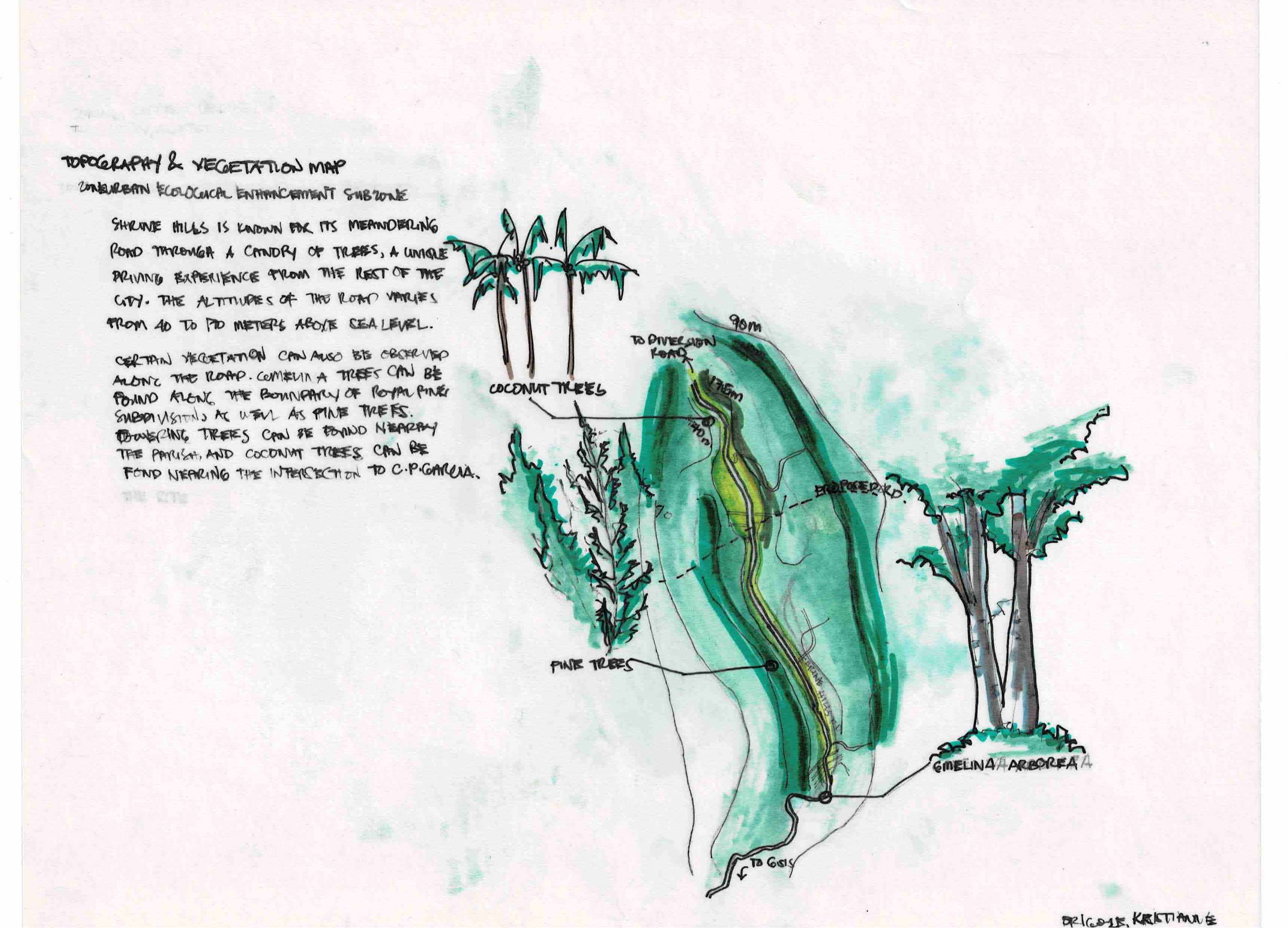
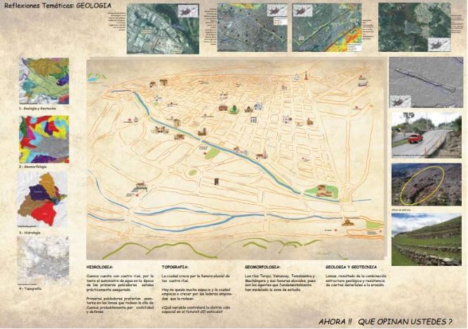
The workshop’s goal was to do the first part of the UNESCO toolkit which was doing a comprehensive survey of the site or city’s natural, cultural and human resources.The pilot testing of the workshop was at Shrine Hills.
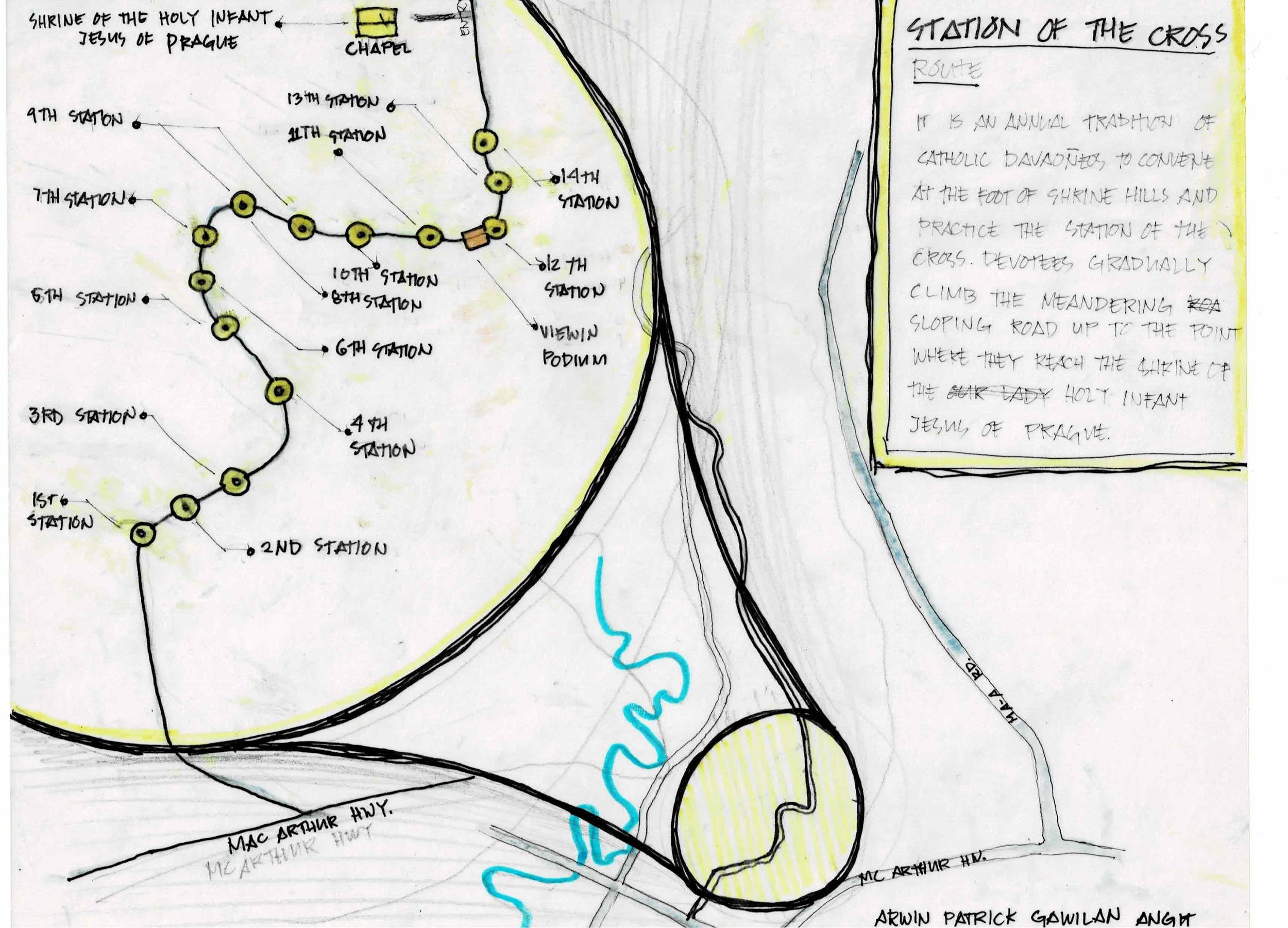
Based on the short half day study of Shrine Hills, the site has many layers of natural, cultural and human resources. There is the layer of Shrine Hills at present, Shrine Hills War Period, Shrines Hills before WWII, Shrine Hills Spanish Period, Shrine Hills and Natural Resources, Shrine Hills and Vistas and Shrine Hills and its intangible culture which is evident on its significance for the Catholic Faith.
The workshop first mapped out the current Shrine hills natural resources as well as its Intangible Heritage Map of the Stations of the Cross. It was also recognized during the workshop that the hill is an important vantage point for the view of the Davao Gulf which can be experience in Jack’s Ridge. Aside from this, it was also recognized during the workshop that Shrine Hills is an important hill for Davao from the vantage point of the lower areas of the city because it is one of the areas that can be considered a highland. One can view Shrine hills from the MAA Road and see the hill’s wonder.
Aside from its present day relevance, Shrine Hills has an significant historical layer. In the World War II period, the land where Jack;s Ridge sits on was actually part of the Japanese forces headquarters. When the Americans landed in May 1, 1945, the Japanese moved their way up to the hills where they can have a better view of the Davao Gulf.
Despite these known facts that can be seen when visiting Jack’s Ridge or walking on the long strength of the main road of the hill, facts of the hill’s historic landscape in terms of Spanish Period and Pre Spanish Period remain a mystery to the public.
There are talks that the Bagobo tribe used to reside in the hill. There are also questions as to why the hill still has large clamps. A lot of hypothesis can be made while going around the surroundings of the hill and a lot of stories can be assumed while looking at the flora and fauna and the ecological make up of this wondrous place. Further study both academic, multidisciplinary projects and applied arts can be encourage.
This kinds of realization of the site’s different natural, cultural and human resources can be an opportunity for a city wide mapping. The maps that are made can be the basis for the city’s cultural interpretation design of its cultural identity that can be seen in the design inspiration of building and infrastructures such as fencing, foothbridges, parks and even the renovation of old and new civic buildings. Soon with this process, there will be a more vibrant city of Davao with more character and identity.
About the Author:
Ar. Gloryrose Dy Metilla is a Architect and Heritage Professional. She manages SwitoDesigns, Inc., a Architectural firm based in Davao focusing on Cultural Heritage themes. She gained her masters degree of Masters in Urban and Cultural Heritage at the University of Melbourne, Australia.
By Ar. Gloryrose Dy, UAP, MUCH